Largest Province in Canada: By Area, Population & Rankings
Canada’s geography holds a quiet surprise for anyone who looks past the headlines: the country’s most populous province and its largest by land area aren’t the same place. Ontario draws the crowds, but Quebec takes up more room. Understanding how these rankings work—and why the difference matters—means untangling a few common assumptions about what “largest” actually means.
Largest province by area: Quebec (1,542,056 km²) · Largest province by population: Ontario (~14.3M) · Smallest province: Prince Edward Island · Provinces: 10 · Territories: 3
Quick snapshot
- Quebec is the largest province by area at 1,542,056 km² (World Atlas)
- Nunavut is the largest overall subdivision at 2,093,190 km² (World Atlas)
- Canada has 10 provinces and 3 territories (World Atlas)
- Precise 2021 census population for Quebec varies slightly across sources
- Post-2021 official demographic estimates from Statistics Canada limited in current data
- 1999: Nunavut created as Canada’s newest territory
- 2016–2021: Canada’s population grew 5.24% between censuses
- Ontario’s 2026 projections show continued growth toward 16.1 million residents
- Yukon led all regions with 12.1% growth from 2016–2021
Canada’s provincial rankings by area and population show an inverse relationship that shapes federal representation. The table below summarizes the key metrics for all provinces and major territories.
| Measure | Value |
|---|---|
| Total provinces | 10 |
| Largest by area | Quebec |
| Quebec area | 1,542,056 km² |
| Largest territory | Nunavut |
| Smallest province | Prince Edward Island |
What is the largest province in Canada by area?
Quebec claims the title of Canada’s largest province, spanning 1,542,056 km² and accounting for 15.4% of the country’s total land area. Ontario comes in second among provinces at 1,076,395 km², followed by British Columbia at 944,735 km² and Alberta at 661,848 km². Combined, these four provinces cover the majority of Canada’s usable southern territory.
The territories tell a different story. Nunavut alone covers 2,093,190 km², making it the largest single subdivision in Canada—but Nunavut is a territory, not a province. Northwest Territories ranks third overall at 1,346,106 km², while Yukon rounds out the territorial picture at 474,391 km².
Quebec’s land area details
Quebec’s massive footprint stretches from the Atlantic coast deep into the continent, encompassing vast forests, the Canadian Shield, and extensive freshwater systems. The province’s size reflects its pre-confederation boundaries, which were established centuries before modern cartography refined our understanding of northern geography.
Comparison to territories
Territories occupy over a third of Canada’s total land area yet are home to just 0.32% of the national population. Nunavut, despite being larger than Ontario, Quebec, British Columbia, and Alberta combined, had only about 41,000 residents as of 2021. This extreme density gap—Nunavut covers 2,093,190 km² with fewer people than a small town—underscores how different “largest” looks depending on whether you’re measuring land or people.
What is the largest province in Canada by population?
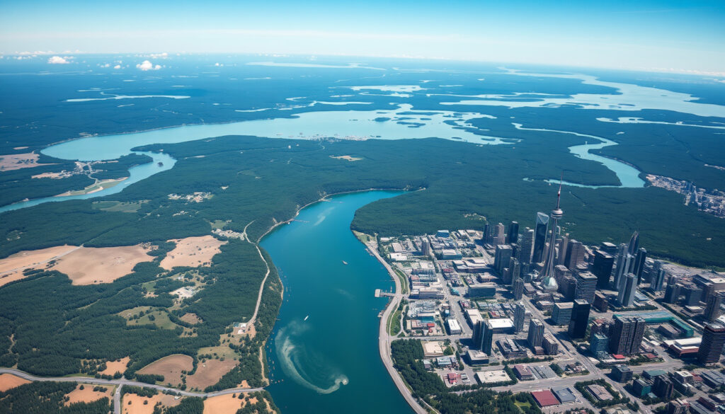
Ontario is Canada’s most populous province, home to 14,262,635 residents according to the 2021 census. That’s nearly 40% of the entire country living in a single province, concentrated primarily in the Greater Toronto Area and the Windsor-to-Ottawa corridor along the Canada-US border.
Quebec ranks second with an estimated 9 million residents, followed by British Columbia at roughly 5.7 million and Alberta at 4,262,635. The combined population of these four provinces—Ontario, Quebec, British Columbia, and Alberta—reached 86.5% of Canada’s total population as of 2021.
Ontario’s population stats
Ontario’s dominance reflects its geographic advantages: the Great Lakes waterway, fertile farmland, major metropolitan hubs, and proximity to the US market. Toronto alone accounts for roughly 2.7 million residents, making the city larger than every other provincial capital combined. The province’s 2026 Q1 population projections show continued growth toward 16.1 million residents, driven by immigration and interprovincial migration.
Top provinces by population ranking
Here is how the provinces rank by 2021 census population:
- Ontario: 14,262,635
- Quebec: ~9,033,887 (2026 estimate; 2021 census figure varies by source)
- British Columbia: ~5,722,318
- Alberta: 4,262,635
- Manitoba: 1,342,153
- Saskatchewan: ~1,132,505
- Newfoundland and Labrador: ~522,103
- New Brunswick: ~775,610
- Nova Scotia: ~969,383
- Prince Edward Island: ~166,000
What is the smallest province in Canada?
Prince Edward Island holds the distinction of being Canada’s smallest province by both area and population. It covers just 5,660 km²—about the size of Delaware—and had approximately 166,000 residents as of recent estimates. Despite its diminutive footprint, PEI punches above its weight in agricultural output and cultural visibility, famous for its red sand beaches, potatoes, and Anne of Green Gables legacy.
Prince Edward Island overview
The province is a single island connected to mainland New Brunswick by the Confederation Bridge, the world’s longest bridge over icy waters. Its small scale means every corner of PEI is within an hour’s drive of the coast, and its population density is among the highest in Canada—a sharp contrast to the territories’ vast emptiness.
Size comparisons
To put PEI’s size in perspective: Quebec could fit inside Nunavut, but Nunavut itself could fit inside PEI roughly 369,000 times if you ignore the fact that the territory has no land suitable for such a thought experiment. More practically, PEI is about 58 times smaller than the next smallest province, New Brunswick, and roughly 272 times smaller than Quebec.
What is the second-largest province in Canada?
Ontario ranks as Canada’s second-largest province by area, covering 1,076,395 km². By population, however, Ontario stands alone in first place. This duality—second by land, first by people—defines Canada’s geographic paradox. The provinces that take up the most room do not always hold the most residents.
By area and population rankings
When ranked by area, Ontario trails only Quebec. British Columbia takes third place among provinces, with Alberta fourth. But when population is the metric, the order flips dramatically: Ontario, Quebec, British Columbia, Alberta. Only the top four remain consistent across both rankings.
Key facts
The gap between Ontario’s area rank and population rank illustrates how geography and demographics don’t always align. Ontario’s 1,076,395 km² holds 14,262,635 people, while Quebec’s larger 1,542,056 km² holds fewer residents. This happens because Ontario’s southern corridor—particularly the Toronto-to-Windsor strip—offers climate, water access, and economic opportunity that Quebec’s more northerly terrain cannot match at the same scale.
What are the 10 provinces of Canada?
Canada consists of 10 provinces and 3 territories. The provinces are sovereign in many respects under the Constitution Act of 1867, with their own elected governments handling education, healthcare, and natural resources. The three territories—Yukon, Northwest Territories, and Nunavut—operate under federal oversight, with governance responsibilities shared between territorial and national authorities.
Full list with sizes
The provinces, listed from largest to smallest by area:
- Quebec: 1,542,056 km²
- Ontario: 1,076,395 km²
- British Columbia: 944,735 km²
- Alberta: 661,848 km²
- Saskatchewan: 651,900 km²
- Manitoba: 647,797 km²
- Newfoundland and Labrador: 405,212 km²
- Nova Scotia: 55,284 km²
- New Brunswick: 72,908 km²
- Prince Edward Island: 5,660 km²
Territories vs provinces
The distinction matters constitutionally. Provinces have defined borders and significant self-governance; territories have boundaries that can be adjusted by Parliament, and their governments derive authority from federal legislation rather than the Constitution. Nunavut, created in 1999 from the division of Northwest Territories, remains the newest addition to Canada’s territorial map.
Territories account for over a third of Canada’s area but only 0.32% of its population, meaning federal infrastructure spending and representation face structural mismatches between geography and democracy.
Ontario accounts for nearly 40% of Canada’s total population, giving the province outsized influence in federal elections, interprovincial trade negotiations, and national economic planning—a weight that its land area ranking alone would not predict.
Population and area rankings reveal dramatically different pictures of Canada’s provinces. Quebec is the largest by land mass, while Ontario leads in residents, and the territories remain vast but nearly empty.
| Province/Territory | Area (km²) | Population (2021 est.) | Rank by Area | Rank by Pop. |
|---|---|---|---|---|
| Quebec | 1,542,056 | ~9,033,887 | 1 | 2 |
| Ontario | 1,076,395 | 14,262,635 | 2 | 1 |
| British Columbia | 944,735 | ~5,722,318 | 3 | 3 |
| Alberta | 661,848 | 4,262,635 | 4 | 4 |
| Saskatchewan | 651,900 | ~1,132,505 | 5 | 6 |
| Manitoba | 647,797 | 1,342,153 | 6 | 5 |
| Nunavut (territory) | 2,093,190 | ~41,159 | — | — |
| Northwest Territories (territory) | 1,346,106 | ~45,074 | — | — |
| Yukon (territory) | 474,391 | ~43,000 | — | — |
| Prince Edward Island | 5,660 | ~166,000 | 10 | 10 |
The area rankings reveal little about where Canadians actually live.
How have Canada’s provincial populations changed?
Canada’s total population stood at 36,991,981 in the 2021 census, up from 35,151,728 in 2016—a growth of 5.24% over five years. This increase was not distributed evenly. Yukon led all regions with 12.1% growth, followed by Prince Edward Island at 7.99%. Ontario and Alberta also posted strong gains, while Newfoundland and Labrador and New Brunswick grew more slowly.
Its four largest provinces by area (Ontario, Quebec, British Columbia, and Alberta) are also its most populous; together they account for 86.5 percent of the country’s population.
The territories account for over a third of Canada’s area but are home to only 0.32 percent of its population. Nunavut, despite covering more land than any province, had roughly 41,000 residents—fewer than many mid-sized Canadian cities. This extreme imbalance reflects the Arctic climate, limited infrastructure, and the fact that Indigenous communities, while significant, are spread across vast distances.
Quebec is the largest province in the country, occupying 15.4% of the country’s total area.
— World Atlas (Canadian Provinces by Size)
Population concentrates near the Canada-US border for clear reasons: warmer climate, agricultural viability, waterway access, and historical settlement patterns that date back to colonial era. Even today, 86.5% of Canadians live within 300 km of the southern border, leaving enormous territories largely uninhabited.
Related reading: Sainte-Monique Landslide Quebec · Mon Dossier Santé Québec
youtube.com, maptive.com, worldatlas.com, stats.gov.nl.ca, trailsunblazed.com, www150.statcan.gc.ca, canadianaffair.com
Ontario surpasses Quebec in population numbers, with the 2024 population estimates by province offering a detailed breakdown across all ten provinces and territories.
Frequently asked questions
Is Nunavut a province?
Nunavut is a territory, not a province. It covers 2,093,190 km², making it larger than any Canadian province, but territories have different constitutional status than provinces. Nunavut was created in 1999 from the eastern portion of Northwest Territories.
How many provinces does Canada have?
Canada has 10 provinces: Alberta, British Columbia, Manitoba, New Brunswick, Newfoundland and Labrador, Nova Scotia, Ontario, Prince Edward Island, Quebec, and Saskatchewan.
What is the largest territory in Canada?
Nunavut is the largest territory in Canada, covering 2,093,190 km². The other two territories are Northwest Territories (1,346,106 km²) and Yukon (474,391 km²).
Does the royal family own 90% of Canada?
No. This is a persistent myth. The Crown does hold significant land holdings through the Canadian government and various institutions, but private individuals, corporations, and provincial governments own the vast majority of Canadian territory.
Where is most freshwater in Canada?
Canada holds about 20% of the world’s freshwater, and much of it sits in the Great Lakes, which Ontario shares with the United States, and in Quebec’s northern lakes and rivers. Nunavut’s Arctic lakes also hold enormous freshwater reserves.
What are Canada’s official symbols?
Canada’s national animal is the beaver, the national bird is the gray jay (also called the Canada jay), and the national tree is the sugar maple. The maple leaf appears prominently on the flag.
What is the second-largest province by population?
Quebec is the second-largest province by population, with an estimated 9 million residents. The 2021 census figure for Quebec varies slightly across sources depending on how Indigenous communities were counted.
What is the fifth largest province in Canada by area?
Saskatchewan ranks fifth among provinces by area, covering approximately 651,900 km². By population, Saskatchewan ranks sixth, demonstrating another instance where area and population rankings diverge across Canadian provinces.
For provincial politicians and federal negotiators, the population-versus-area paradox is not academic—it determines seat counts, funding formulas, and infrastructure priorities. Ontario’s near-40% population share gives it leverage that Quebec, despite its land mass, cannot match. The territories, meanwhile, receive federal transfers that their tiny populations cannot generate through taxation, making geographic scale irrelevant to their political calculus.
More related posts
 MOVA P10 Pro Ultra Review: Specs, Problems, Value
 Blue Jays vs Pirates: Odds, Predictions and Player Insights
 Sunrise on the Reaping Cast: Haymitch, Effie & Snow Revealed
 Teri Hatcher: Career, Net Worth, and Plastic Surgery
 What to Watch on Netflix Canada – Top Movies and Shows Now
 Live Canada Election Results 2025: Seat Count & Map Updates
 Red Lobster Seafood Boils: Menu, Prices & Health Guide
 How Many KM is a Marathon? 42.195 km Exact Distance
